Sigma nought or backscatter coefficient is the normalised measure of the radar power reflected from a distributed target per unit area over the ground.
¶ Product overview
Backscatter is the portion of an outgoing radar signal that is reflected back to the sensor. Backscatter coefficient or sigma nought (SIG0) is the normalised measure of the radar power reflected from a distributed target, which is calculated per unit area over the ground. In the Austrian Data Cube, Sentinel-1 input data originates from C-band Interferometric WideSwath (IW) and Ground Range Detected (GRD) products. Pre-processing is applied in order to retrieve sigma nought images for every polarisation and timestamp. For example, an input data file which has dual polarisation Vertical-Vertical (VV) and Vertical-Horizontal (VH) will end up in two SIG0 images.
¶ Product description
The processing of the SIG0 product is carried out using the TU Wien SAR Geophysical Retrieval Toolbox (SGRT), which is a software for geophysical parameter retrieval from SAR imagery developed at TU Wien. In the following sub-sections, the main characteristics and the data format of the Sentinel-1 SIG0 product will be presented.
¶ Product variables
The following table presents the data format of the SIG0 product after the processing at TU Wien.
| Code name | Scaling factor | Units | Type | Pixel size (m) | Image dimension | No-data | Number of bands |
|---|---|---|---|---|---|---|---|
| SIG0 | 100 | Decibel | int16 | 10,10 | 10000x10000 | -9999 | 1 |
Overview of the Sentinel-1 Sigma nought product
¶ Area and time period
The SIG0 product is provided over Austria from 01st January 2016 to the present.
¶ Temporal resolution
The temporal resolution of the SIG0 product is up to 3-4 days over Austria in practical.
¶ Polarisation
As discussed above, the polarisation of the SIG0 product depends on the original polarisation of the input data. The SIG0 images for each polarisation will be stored independently of each other.
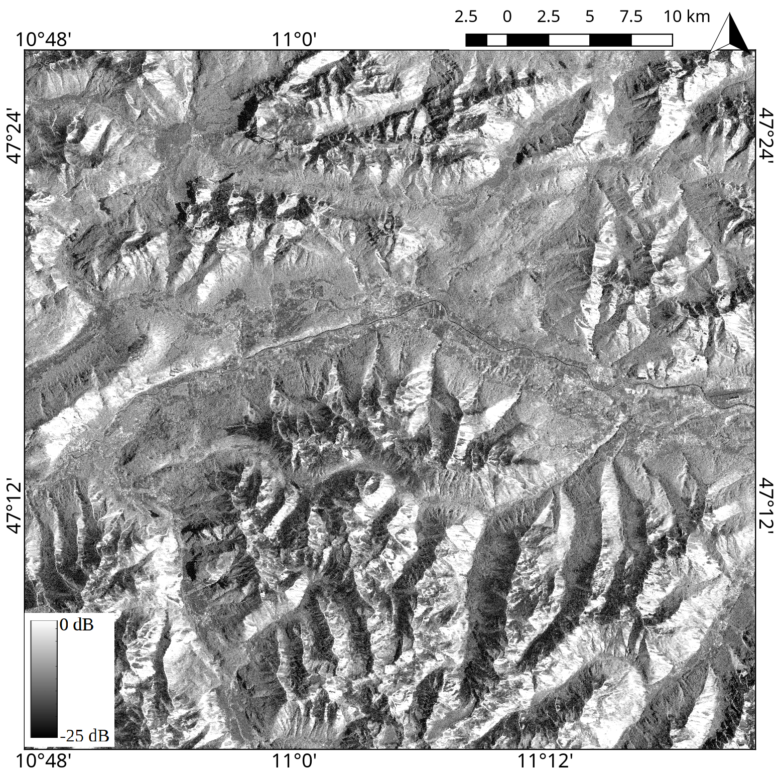
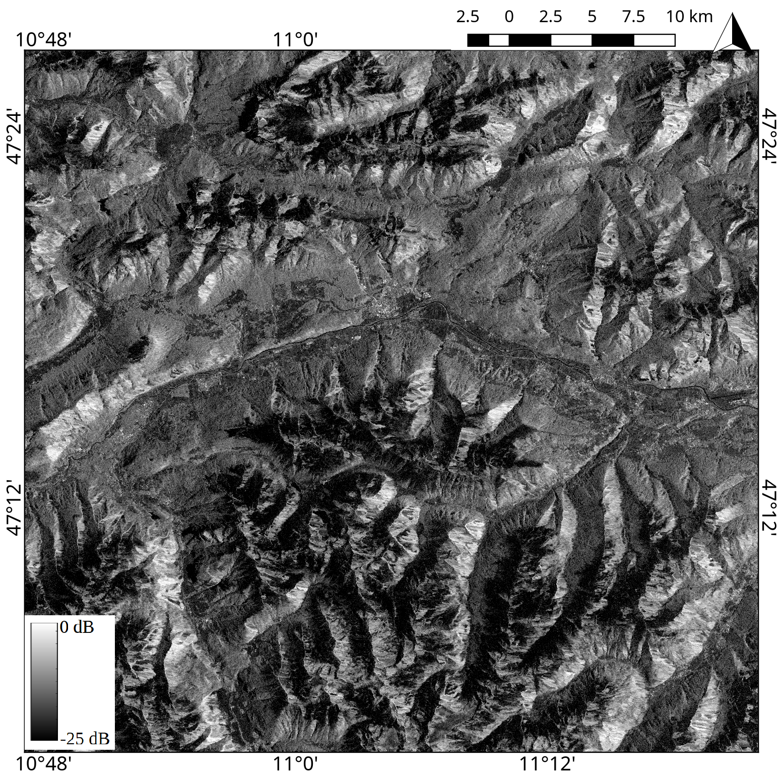
The figure below is a visualisation of VV and VH-polarised SIG0 data over the same area and with the same color scale.
 |
 |
Sentinel-1 Sigma nought or backscatter coefficient product at 10m spatial sampling, with VV polarisation (left) and VH polarisation (right). The scene covers the area of western Innsbruck, Austria, taken on 21st April 2016, 5:26:30'.
¶ Image timestamps
The timestamp of SIG0 product is included in the filename, according to the Sentinel file naming convention. It can also be found in the GeoTIFF header.
¶ Spatial resolution and sampling
After the pre-processing at TU Wien, the SIG0 images are tiled and georeferenced using the TU Wien Equi7 grid system (see General concepts) and have easting and northing coordinates with a pixel spacing of 10m.
¶ Original data format
The SIG0 data is originally stored and delivered in GeoTIFF format. GeoTIFF is a standard which allows storing georeferencing information within a TIFF raster image.